
There are a lot of reasons why I’m moving from California to Washington, including family and other personal considerations. But one reason, one big reason, is California’s rapidly changing climate.
It was late February in the Coast Range of northern California when I was wearing shorts and a t-shirt. Dust swirled around my car in the dirt parking lot at Cold Canyon. The car thermometer, warmed by a sun that felt imported from Palm Springs, said 87 degrees; it was actually only 77. A hint of ash, omnipresent since The Fire last summer, remained in the air.
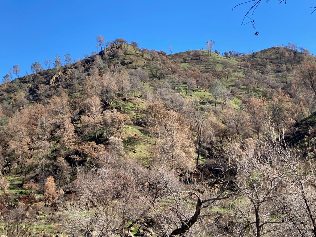
The hillsides were green with the new growth of non-native grass, which was responding to a recent heavy rain. That was deceptive. More than half the rain we’d had in the previous eight months came in that single event. We had six inches of rain in all of 2020. Looking beyond the grass, nearly every tree – blue oaks and gray pines – on the hillsides was dead, burnt black and orange monuments to a previous era. For our local blue oak woodland, that era ended last year and, given that recruitment of saplings is unlikely due to heat, fire, and cattle, it was an era that will never return.
Massive die-offs are eliminating blue oaks from the southern third of their range. Black oaks are marching up the Sierra, displacing Ponderosa pine, which are marching up, displacing firs. Everyone is on the move. Oak woodlands are becoming oak savannahs, oak savannahs are becoming grasslands, grasslands are becoming rocky high deserts. Arizonification is happening quickly, thru heat, drought, and ultimately, thru fire.
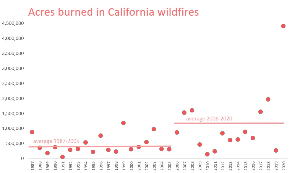
Virtually all of the east slopes of the Coast Range between San Francisco Bay and the Trinity Alps has burned in the past ten years. In the Sierra, one can practically predict where the next fire catastrophe will happen, because it hasn’t burned yet (hint: Lake Almanor, Placerville, Arnold).
It was a beautiful day—for April. But February has become April, April has become May, and June, July, August, September, and even October and November have become unrecognizable. Every year more heat records are broken. Hottest summer, hottest month, most days over 100, most days over 90. The list goes on, each year breaking the records set the previous year. Weather data is normally highly variable; now it is a straight line—warmer and warmer. And smokier.
My cape honeysuckle and bougainvillea, both planted with a degree of optimism outside their recommended zone, used to die back so badly in the winter that each spring I was tempted to declare them dead and pull them out. Now they bloom year-round, looking like they’re in a courtyard at a hotel in the tropics. We haven’t had a real freeze in seven winters.
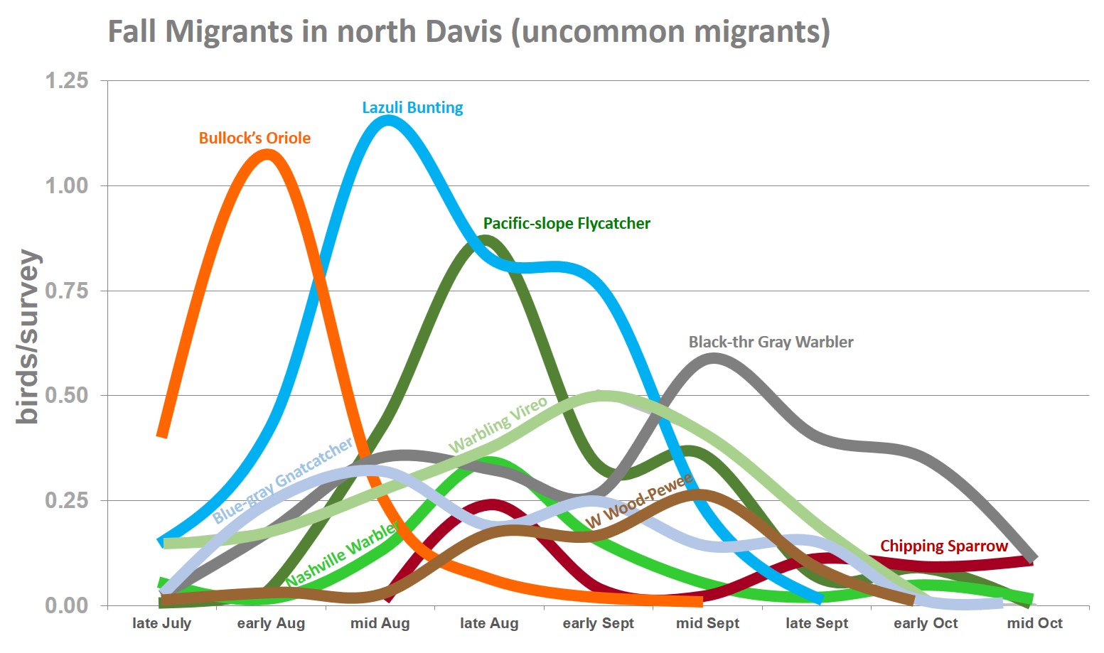
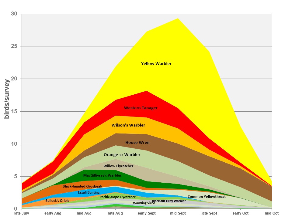
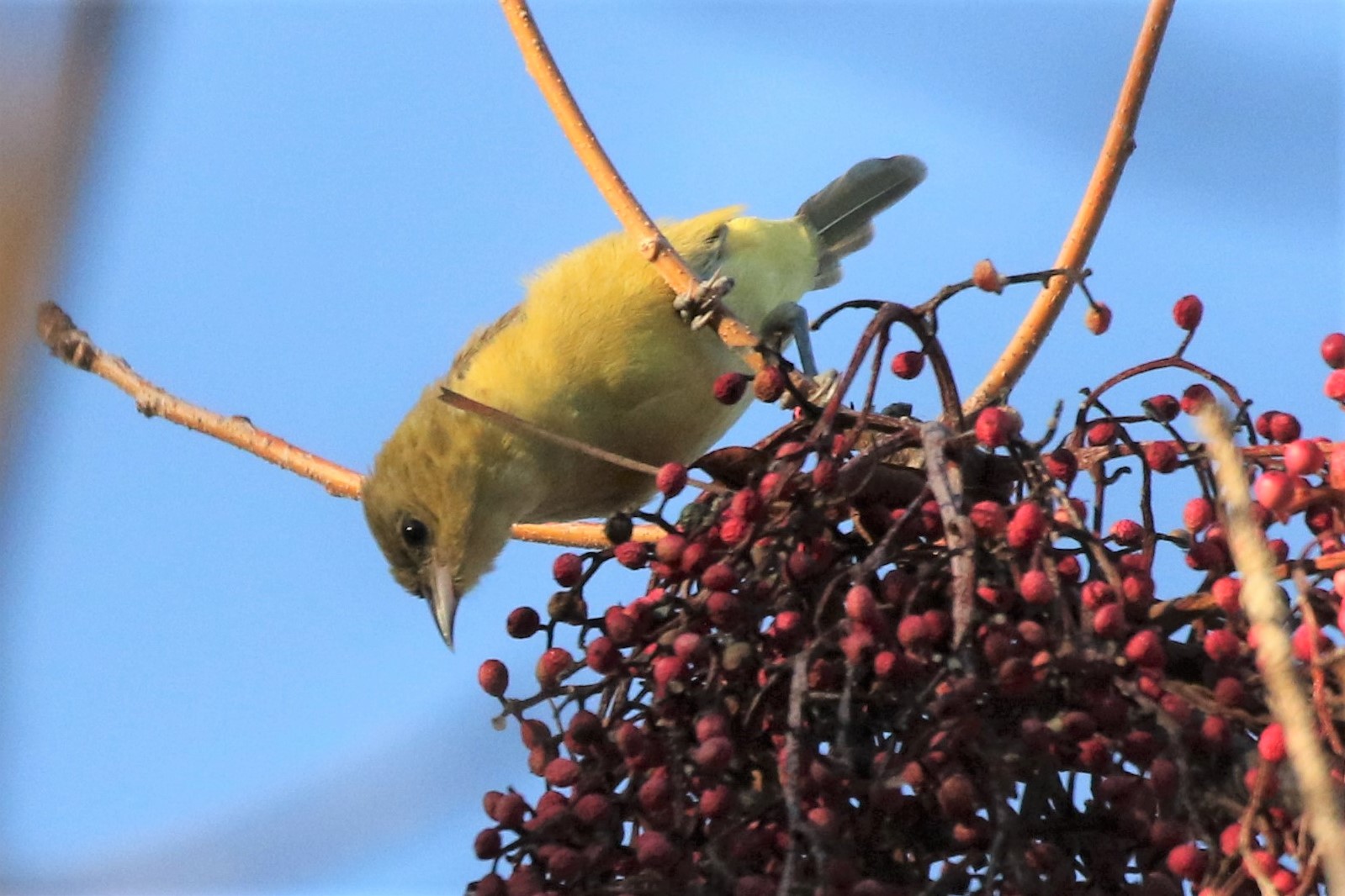
The songs of lesser goldfinches on my street are a depressing warning. I can’t take two steps outside without seeing or hearing a bird that reminds me that our climate has seriously changed. Western tanagers, house wrens, and turkey vultures are regular in winter now. The lesser goldfinches have come out of the arid hills and are quickly becoming one of the most ubiquitous nesting birds in Davis. (I know this definitively because one included an imitation of a canyon wren in its song.) What’s more, at least four Say’s phoebes, essentially a high desert species, are scouting for nests in town now. A fifth arrived on my block last week, singing as if on territory. They’ve been doing this for a few years and their numbers are growing.
I’m leaving. I’ve lived in California fifty-five years but it’s no longer the state I grew up in.
We’re headed to the Olympic Peninsula in Washington. We are fortunate to be able to do so.
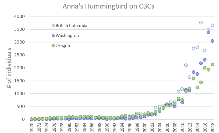
Besides the cooler summers, one of the best things about moving to a new place is that I won’t be reminded of climate change on a daily experiential basis. Because the ecosystem will be new to me, I won’t know what’s different, what is changing, except maybe for the brown boobies, a tropical seabird, that are now showing up in Puget Sound each year. Or the family of California scrub-jays that have just established residence on my new street. Like Anna’s hummingbirds, black phoebes, great egrets, red-shouldered hawks, and people like me, scrub-jays are moving north. I expect more of California’s birds to follow me, just as I follow some of them. Yes, lesser goldfinches are coming north too; they’re already established southeast of Tacoma.
I feel like a frog in a boiling pot. I’m getting out. I’m saying goodbye to California, but I feel it has left all of us without saying goodbye to anyone.

I do believe that Homo sapiens may ultimately win the climate battle and bring atmospheric CO2 back down to 300 ppm or something. But that’s a hundred years off. And there’s no guarantee we can stop the tide of Greenland and Antarctic ice melt to prevent sea level rise. In the meantime, in the next 50 to 100 years, it’s going to get a lot warmer. And we may ultimately lose New York City, Singapore, Mumbai, and every other low-lying coastal city. My new home is fifty feet above sea level. Well, probably forty-nine and a half now.


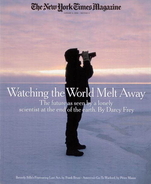 “Watching the World Melt Away: The future as seen by a lonely scientist at the end of the earth.” The article was about seabird biologist George Divoky and his decades of work studying the black guillemot, a high arctic seabird, on Cooper Island off the coast of Barrow, Alaska. The guillemots were struggling to feed their chicks. Their preferred food, Arctic cod, lived at the edge of the sea ice. In the past, this was five miles from the island. Now it was thirty. Divoky, moreover, found himself sharing his tiny island with several hungry polar bears stranded by the vast expanse of open water. At the time, the story was one of the first concrete examples of climate change impacting an ecosystem in way that was easily seen and understood.
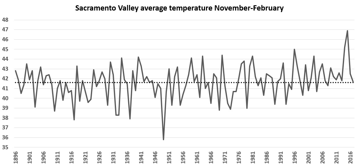
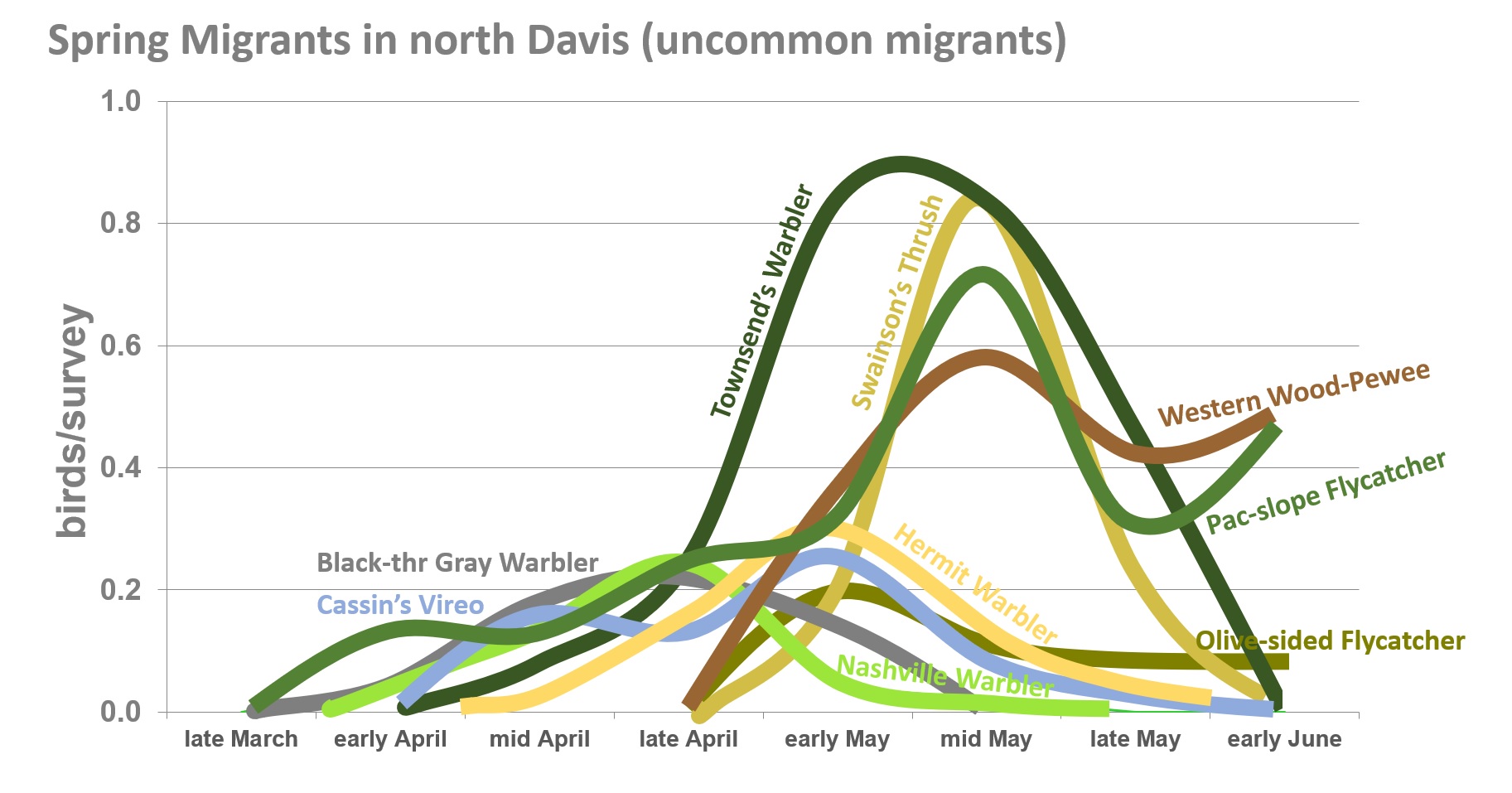
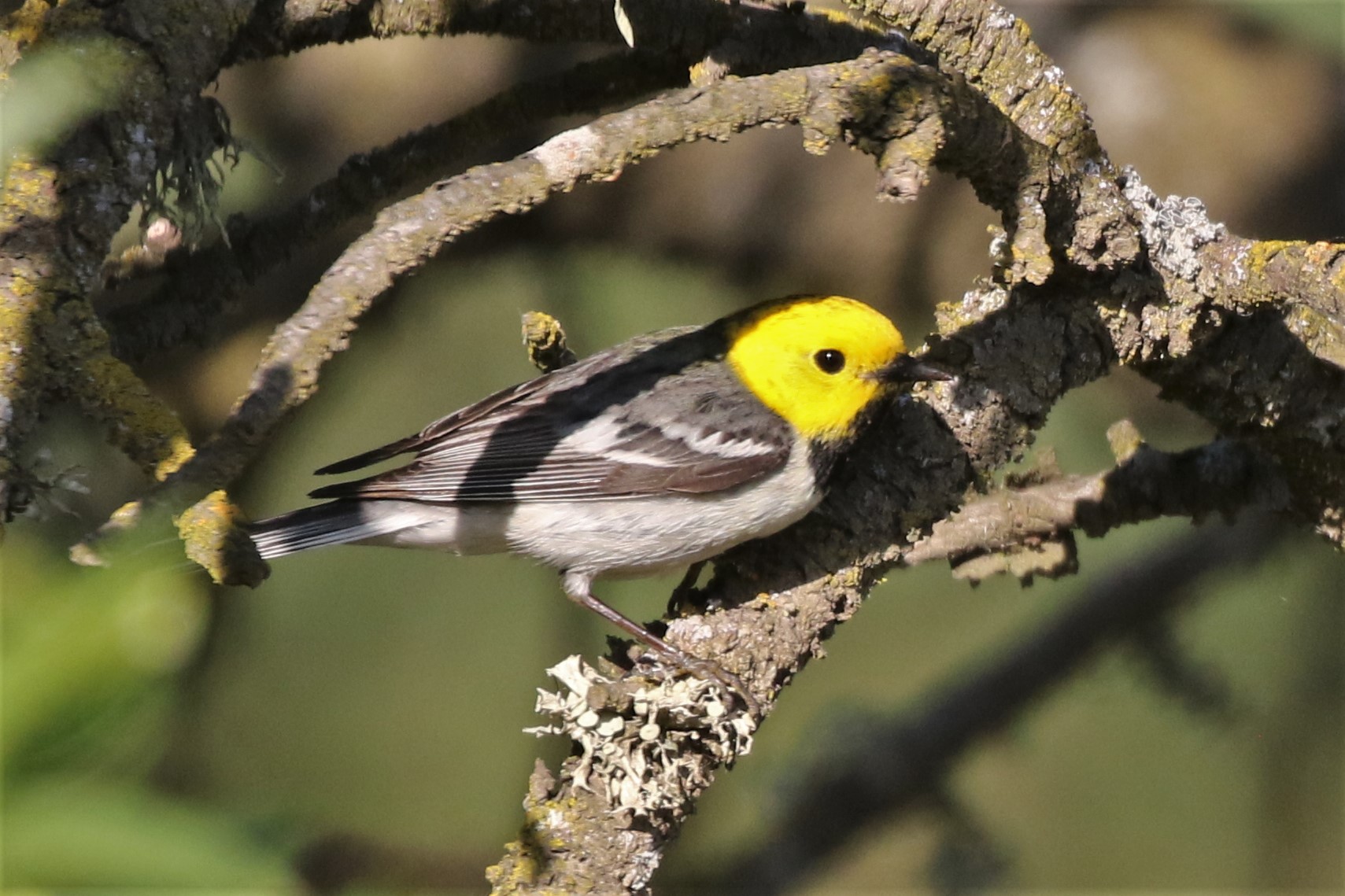
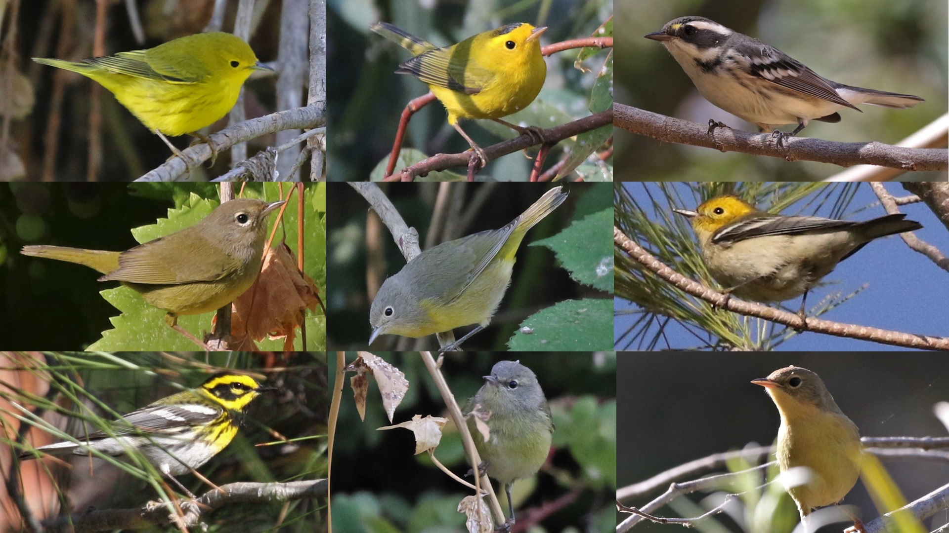
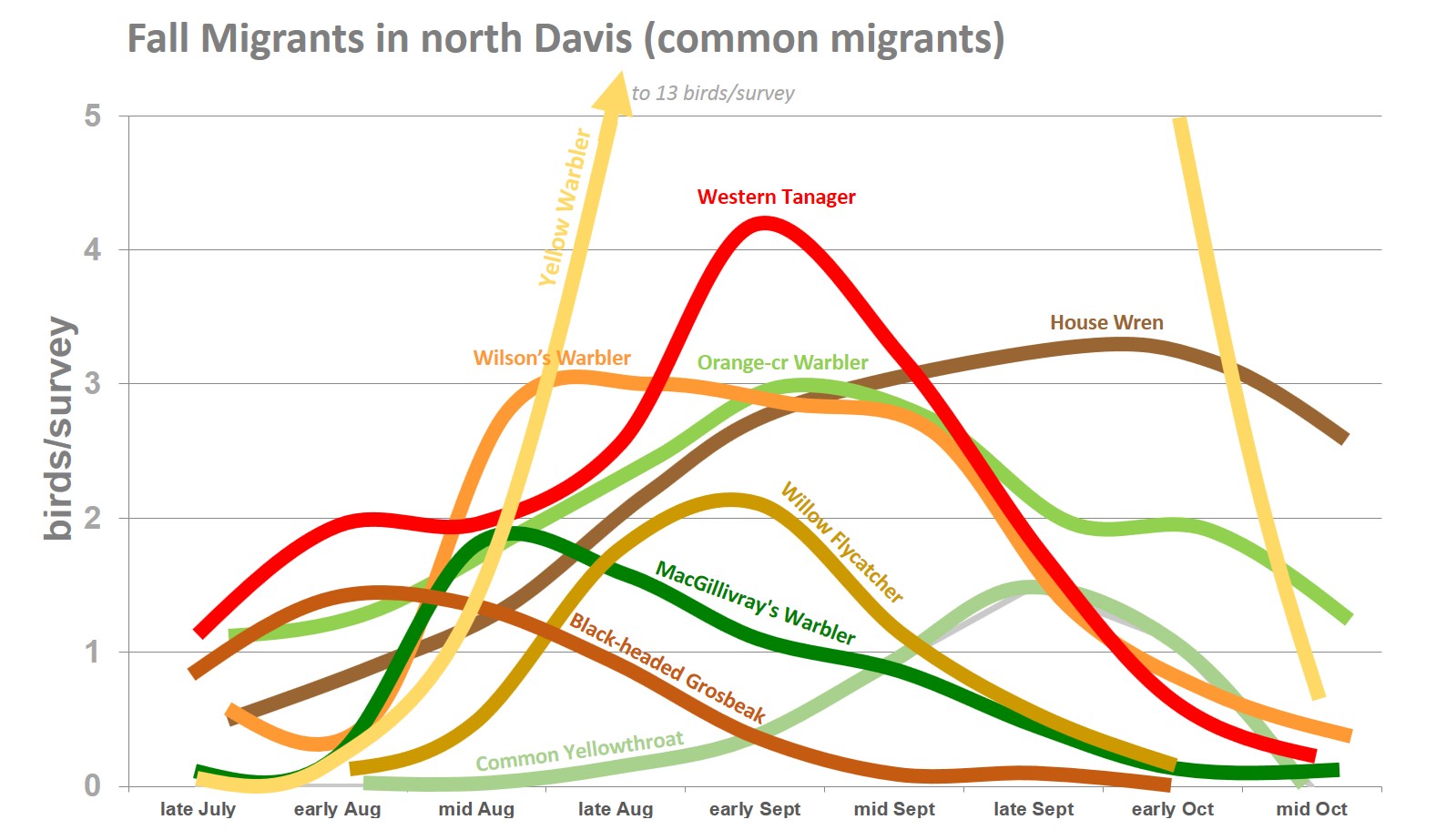
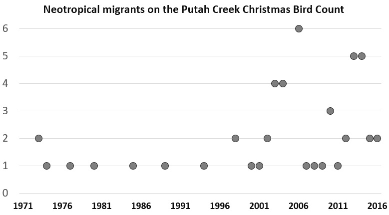 The Putah Creek Christmas Bird Count, an annual effort to count all the birds in a 15-mile diameter circle near Winters on one day each December, has tracked winter bird populations since 1971. In recent years, the number of neotropical migrants found on the count has swelled. These include warbling vireo and Wilson’s and Townsend’s warblers, in addition to the species mentioned above. Perhaps the most dramatic shift in the count data has been with the turkey vulture. With the absence of tule fog, these birds, which rely on warm thermals to give them some lift, have gone from sparse, rarely more than 15 birds on a count through 1985, to over 150 individuals per count in each of the past eight years.
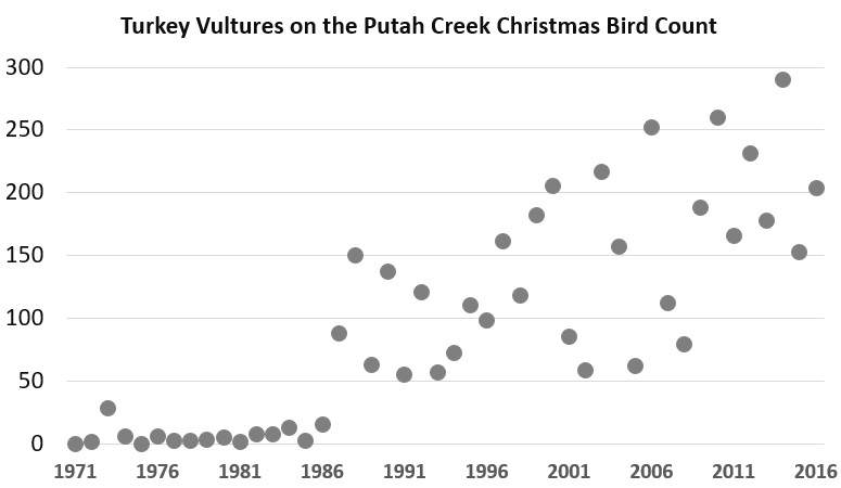 A warming climate is expected to create more increases than decreases in bird life in Yolo County. This is because species diversity is greatest in the tropics. As bird ranges shift north, we expect to see more arrivals than departures. Among the departures are some northern species that are growing scarcer in winter. Most notable is rough-legged hawk, a tundra species that journey south to agricultural areas to eat rodents in winter. They have, however, become decidedly hard to find in recent years, perhaps finding the Willamette Valley and other more northern valleys suitable for their wintering grounds. Another species to watch is the beautiful cedar waxwing, which descend on fruits and berries in the winter months. The more they can find food in the north, the less likely they will come this far south. They are erratic from year to year, however, so it is too early to identify a trend.